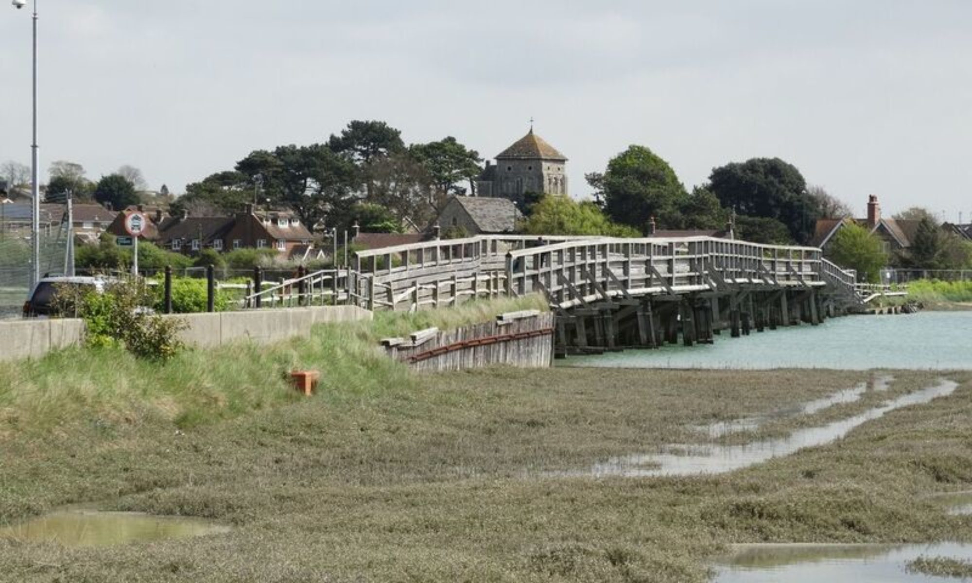
Weather in Shoreham – May 2019

Dry and Rather Warm 

Temperatures

The average maximum temperature during May 2019 in Shoreham was 17.3 Celsius (63F), and that was around 2 degrees Celsius (3.5F) above normal for the time of year. The average minimum temperature was 8.2 Celsius (47F), and that was  around  1  degree Celsius (1.5F) below the May normal.    

The highest temperature recorded during the month was 21.8 Celsius (71F) on the 24th, but both the 21st and 25th had maxima above 20 Celsius (68F). There were a further 13 days with highs between 18 and 20 Celsius (64-68F), although only 2 of these warmer days occurred during the first half of the month. There were no particularly cold days during May, but on 5 occasions the temperature failed to rise above 15 Celsius (59F). One of these cooler days occurred as late as the 29th, and on the 17th the temperature only reached 12.8 Celsius (55F). However, there were 3 consecutive cool days beginning on the 4th, and in fact the 4th was the coolest day of the month with a high of 12.2 Celsius (54F).

There were no particularly warm nights during  May, but on 8 occasions, all during the second half of the month,  the temperature stayed above 10 Celsius (50F). On 3 of these nights the temperature stayed above 12 Celsius (54F). On the 25th, a minimum of 14.2 Celsius (58F) was recorded, with 13.6 Celsius (57F) and 13.7 Celsius (57F) measured on the 30th and 31st respectively. All the coldest nights of the month occurred during the early part of May with no minima below 7 Celsius (45F) after the 16th. Prior to that date, there were 13 nights with temperatures dipping below 7 Celsius (45F), including 6 nights with temperatures below 5 Celsius (41F). All these chilly nights occurred between the 4th and 13th, but there were only 2 occasions when the temperature fell below 4 Celsius (39F). On the 4th a low of 3.8 Celsius (39F) was measured, but on the following night the minimum was 2.1 Celsius (36F). 

The sea temperature gradually rose from 12 Celsius (54F) at the beginning of May to 15 Celsius (59F) by the end of the month.

Frost

There were no air frosts during  May and just 1 grass frost. on the night of the 4th/5th the grass temperature fell to minus 1.1 Celsius (30F).    

Rain

There were  19.4  millimetres (0.75 ins.) of rain during May and that was only around 40% of the monthly average. It was the driest May in the area for 8 years. There were 8 days  of measurable rain, and that was about 4 days below normal for May. The first day of the month was dry and rain on the 2nd was negligible. However, heavy showers on the evening of the 3rd gave over 4 millimetres (0.17 ins.) of rain, and further showers occurred on the 4th.  Heavy rain fell early on the 8th, although the 8.8 millimetres (0.35 ins.) that fell was logged for the 7th (rainfall day 0900-0900 UTC). Showers fell on both the 8th  and 11th but less than 1 millimetre (0.04 ins.) was recorded on each day. From the 12th, there were 14 consecutive dry days, and although this was followed by 4 damp days, amounts of rain were small with 2.4 millimetres (0.1 ins.) on the 29th the highest total. The last 2 days of the month were dry.

Hail

No hail was observed in Shoreham during May.

Thunder

No thunder was heard in Shoreham during May.

Snow

There was no sleet or snow observed in Shoreham during May.   

Wind

On balance, May was a ‘westerly’ month,  although almost a week of northeasterlies occurred around mid month, and the prevailing soputhwesterlies were matched in number (10) by winds from a northwesterly direction.  Winds were quite brisk during the first 9 days of the month, and again during the last week of May. However, overall winds were generally lighter than average. At Shoreham Airport  northwesterly gusts of 31 knots (35 mph) occurred on the afternoon of the 4th, and again on the morning of the 8th, but this time from a southwesterly direction. There were no further gusts above 30 knots (34 mph) during the remainder of the month.     

Fog

There was no fog observed in this part of Shoreham during May, 

Statistics for May 2019

Reporting Station Highest Temp Lowest Temp Rain Total (mm) Wettest Rain days
Shoreham Airport 20.4 1.1 25 12 8
Thorney Island 21.0 2.4 20 10 12
Gatwick Airport 23.1 0.2 39 16 12
Herstmonceux 21.5 2.5 31 16 12
Bournemouth (Hurn) 22.4 -1.6 38 15 11
Middle Wallop 22.6 0.2 25 15 10
Dieppe 23.2 3.2 21 9 10
 

Weather in Shoreham – April 2019

Very Mild and  Dry

Temperatures

The average maximum temperature during April 2019 in Shoreham was 15.2 Celsius (59F), and that was around 3 degree Celsius (5F) above normal for the time of year. The average minimum temperature was 6.7 Celsius (44F), and that was  under  1  degree Celsius (1.5F) above the March normal.    

The highest temperature recorded during the month was 25.2 Celsius (77F) on the 20th, and that appears to be one of the warmest April days in Shoreham for more than 50 years. Remarkably, there were 5 other days when the temperature rose above 20 Celsius (68F), including  highs of 24.3 Celsius (76F) on both the 19th and 21st. All these 6 very warm days were clustered between the 18th and 23rd. On most other days during the second half of the month, maximum temperatures were close to 15 Celsius (59F), but the first half of April was generally much cooler. There were 12 days when the temperature failed to rise above 14 Celsius (57F), with all of these cooler days occurring before mid month. On 6 days, maxima were below 11 Celsius (52F), and this included 2 days, the 2nd and 3rd, with highs below 10 Celsius (50F). The coolest day was the 3rd with a top temperature of 9.2 Celsius (49F).

There were no particularly mild nights during April, but on 6 occasions, all between the 18th and 24th, the temperature remained above 10 Celsius (50F). The mildest night was the 23rd with a minimum of 11.0 Celsius (52F), but the 20th was not far behind with 10.9 Celsius (52F). The coolest nights were also in the first half of the month, and the 7 nights with minima below 5 Celsius (41F)  all occurred before the 16th. Only 3 nights had temperatures below 3 Celsius (36F). On the 11th a low of 0.8 Celsius (33F) was recorded. On the 3rd it dipped to 0.6 Celsius (33F), but the coldest night of the month was the 14th with 0.2 Celsius (32F). 

The sea temperature gradually rose from 10 Celsius (50F) at the beginning of April to 12 Celsius (54F) by the end of the month.

Frost

There were no air frosts during  April but 7 grass frosts occurred.  Only 1 grass frost occurred after mid month, the 30th, when a grass temperature of minus 0.6 Celsius (31F) was recorded. Most grass frosts were slight, with only 2 nights recording grass minimum temperatures below minus 2 Celsius (28F). On the 14th, minus 2.2 Celsius (28F) was measured, and on the 3rd a grass low of minus 3.3 Celsius (26F) occurred.    

Rain

There were  16.6  millimetres (0.65 ins.) of rain during April and that was only around a third of the monthly average. There were 9 days  of measurable rain, and that was about 3 days below normal for April. After a dry, almost cloudless, day on the 1st, the weather turned cool and showery. On the 2nd 6 millimetres (0.24 ins.) of rain fell, with another 3.8 millimetres (0.15 ins.) on  the 3rd. Rain  and drizzle gave 3 millimetres (0.1 in.)  on the 9th, otherwise, between the 4th and 22nd only 0.4 millimetres (0.02 ins.) of rain fell. The end of the month became unsettled again, but of the 4 ‘rain days’ between the 23rd and 26th, the 24th was the wettest with just 1.8 millimetres (0.07 ins.) and no measurable rain fell after the 26th.

Hail

There was small hail observed late in  the afternoon on the 2nd, and larger soft hail occurred around lunchtime and in the evening on the 3rd.

Thunder

There was thunder mid afternoon on the 2nd.

Snow

There was no sleet or snow observed in Shoreham during April.   

Wind

April was a ‘northeasterly’ month with winds from that direction outnumbering the usual southwesterlies by a ration of 3 to 1. The bulk of the northeasterlies occurred during the second and third weeks,  although there was no prolonged run of southwesterlies at any time during the month. Although the northeast breezes were quite brisk at times, overall it was a less windy April than usual. There was one particularly windy day, however, and that was the 27th when westerly winds were strong for most of the day. At Shoreham Airport,  southerly gusts reached 32 knots (37 mph) on the afternoon of the 4th, but the next period of breezy weather didn’t occur until late on the 26th. A gust of 34 knots (41 mph) from the southwest occurred late in evening, followed by 41 knots (47 mph) in the early hours of the 27th.     

Fog

There was no fog observed in this part of Shoreham during April, 

Statistics for April 2019

Reporting Station Highest Temp Lowest Temp Rain Total (mm) Wettest Rain days
Shoreham Airport 24.0 -1.3 18 7 9
Thorney Island 24.0 -1.3 16 3 8
Gatwick Airport 24.8 -3.0 14 5 10
Herstmonceux 23.8 -0.5 15 4 11
Bournemouth (Hurn) 25.0 -4.0 55 22 11
Middle Wallop 24.1 -2.0 42 21 10
Dieppe 23.7 -1.2 33 10 11
 

Weather in Shoreham -March 2019

Very Mild and Wet, then Dry

Temperatures

The average maximum temperature during March 2019 in Shoreham was 12.5 Celsius (55F), and that was almost 3 degree Celsius (5F) above normal for the time of year. The average minimum temperature was 6.1 Celsius (43F), and that was  close to 1.5  degree Celsius (2.5F) above the March normal. Overall. it appears to have been the mildest March in the area for at least 50 years.   

The highest temperature recorded during the month was 17.4 Celsius (63F) on the 30th, and there were 3 other days with the temperature rising above 15 Celsius (59F). The month was persistently mild with only 6 days having maxima below 11 Celsius (52F) and just 1 of these days had a high below 10 Celsius (50F). That day was the 12th when 9.8 Celsius (50F) was recorded.

There were no particularly mild nights during March, but the temperature on the 3rd only fell to 10.1 Celsius (50F) and there were a further 4 nights when the temperature stayed above 9 Celsius (48F). The mildest nights generally occurred during the first half of March with  only 4 of the 12 nights with minima below 5 Celsius (41F) occurring before mid month. However, the 4 coldest nights, with minima below 3 Celsius (37F),  were equally divided into the 2 halves of March.  The lowest temperatures were 1.9 Celsius (36F) on the 5th and 1.4 Celsius (34F) on the 26th. 

The sea temperature slowly rose from 8 Celsius (46F) at the beginning of March to 10 Celsius (50F) by the end of the month.

Frost

There were no air frosts during  March but 8 grass frosts occurred.  Only 2 grass frosts occurred before mid month, but 3 consecutive grass frosts were recorded between the 24th and 26th. The frosts were slight with only 4 nights having ground temperatures below minus 2 Celsius (28F).  The lowest value was minus 2.8 Celsius (27F) occurring on both the 5th and 26th.    

Rain

There were  44.0  millimetres (1.7 ins.) of rain during March and that was very close to the monthly average. There were 15 days of measurable rain, and that was around 1 day above normal for March. There were no completely dry days between the 1st and 19th, although only a trace of rain was measured on the 11th, 14th, 17th and 19th.  The heaviest rain occurred early in the month with 6.2 millimetres (0.25 ins.) recorded on the 2nd, and a further 7.2 millimetres (0.3 ins.) fell on the 3rd. Over 4 millimetres (0.2 ins.) occurred on the 5th but then rainfall became more sporadic. On the 9th there were 7.0 millimetres (0.3 ins.) of rain with 6.2 millimetres (0.25 ins.) on the 12th. The last measurable rain of the month was on the 18th when 4.4 millimetres (0.17 ins.) fell.

Hail

There was no hail observed in this part of Shoreham during  March.

Thunder

There was thunder and lightning to the southeast at ten minutes past midnight on the 4th.

Snow

There was no sleet or snow obsereved in Shoreham during March.   

Wind

Pressure was higher than normal again during March, but the first half of the month was often windy. On most days the wind was predominantly from the southwest, with only a few breezes from a northeast or southeasterly quadrant. At Shoreham Airport southwesterly gusts exceeded 30 knots (34 mph) for much of the day on the 3rd, peaking at 38 knots (43 mph) in the early evening.  Late on the afternoon of the 4th, west to northwesterly gusts peaked at 41 knots (47 mph). The 7th was windy all day and southwesterly gusts reached 39 knots (44 mph) in the afternoon. The following day was windy in the evening with a gust of 36 knots (41 mph) recorded just before midnight. risk westerly winds gave a gust of 34 knots (39 mph) on the afternoon of the 9th, but then the 10th was very windy with 52 knots (59 mph)  from the west measured late in the morning.  The 12th was windy again with 42 knots (48 mph)  from the southwest early in the afternoon.  The 13th and 14th stayed windy with 42 knots (48 mph) occurring again on the morning of the 14th. There was no let up on the 15th and 16th with regular gusts above 30 knots (34 mph) and a gust of 44 knots (50 mph) on the evening of the 16th. This brought an end to the windy weather and there were no further gust above 30 knots (34 mph) during the remainder of the month.     

Fog

There was no fog observed in this part of Shoreham during March.

Statistics for March 2019

Reporting Station Highest Temp Lowest Temp Rain Total (mm) Wettest Rain days
Shoreham Airport 16.3 -0.9 40 7 15
Thorney Island 15.7 -0.5 60 16 16
Gatwick Airport 19.2 -2.3 80 17 16
Herstmonceux 17.8 -0.1 67 12 16
Bournemouth (Hurn) 17.9 -2.6 79 15 18
Middle Wallop 18.2 0.5 73 16 18
Dieppe 17.4 0.4 61 16 15
 

Weather in Shoreham- February 2019

Mild and Dry

Temperatures

The average maximum temperature during February 2019 in Shoreham was 9.9 Celsius (50F), and that was around 2.5 degree Celsius (4.5F) above normal for the time of year. The average minimum temperature was 4.0 Celsius (39F), and that was  close to 1  degree Celsius (2F) above the February normal. It was the mildest February for 5 years.   

The highest temperature recorded during the month was 15.2 Celsius (59F) on the 26th, with the 25th only 0.1 Celsius (0.2F) less mild. Although much lower than the record-breaking temperatures that occurred in the London area, they were, nevertheless, exceptional for the south coast, and probably haven’t occurred in the area for at least 50 years. The temperature also rose above 12 Celsius (54F) on both the 24th and 27th. There were a further 9 days when the temperature exceeded 10 Celsius (50F),  but with only 4 of these milder days occurring before mid month. During the period between the 6th and the end of the month, only the 10th, with a high of 8.3 Celsius (47F), had a maximum temperature below 9 Celsius (48F). The first 5 days of February, however, were somewhat colder. The 3rd had a high of 6.6 Celsius (44F), but the 1st and 2nd had highs of 4.1 Celsius (39F) and 4.8 Celsius (41F) respectively.

There were no particularly mild nights during February, but on 5 occasions the temperature stayed above 7 Celsius (45F), including 4 consecutive nights commencing on the 6th. On many nights (14) the temperature fell to between 1 and 5 Celsius (34-41F), with only 3 nights having minima below 1 Celsius (34F). The coldest night was the 2nd/3rd with a minimum temperature of minus 2.7 Celsius (27F). 

The sea temperature was 7 Celsius (45F) at the beginning of February, but for most of the month it was close to 8 Celsius (46F).

Frost

There was just 1 air frost during February, and that’s 5 below average. However, there were 16 grass frosts. with the average grass temperature of minus 0.1 Celsius (32F). There was grass frost on the first 3 nights of the month, and on the 3rd a grass minimum of minus 7.8 Celsius (18F) occurred. A frost-free week followed before grass frosts returned on the 11th. A week of grass frosts included minima of minus 3.9 Celsius (25F) on both the 14th and 15th. The 18th was frost-free but the 19th also had a low of minus 3.9 Celsius (25F). A short spell without frost ended on the 24th and the last 5 nights of the month had grass frosts, with the 25th having a grass low of minus 5 Celsius (23F).   

Rain

There were  46.8  millimetres (1.8 ins.) of rain during February and that was only just over half the monthly average. There were 18 days of measurable rain, and that was around 2 days above normal for February. Apart from the 2nd, rainfall was measured on each of the first 10 days of February. Totals included 7 millimetres (0.3 ins.) on the 3rd, almost 5 millimetres (0.2 ins.) on both the 4th and 5th, 6 millimetres (0.25 ins.) on the 6th, and 9 millimetres (0.35 ins.) on the 9th, the wettest day of the month. No rain fell between the 11th and 16th, however, the nights were very moist and unusually, a combination of frost and dew produced a total ‘rainfall’ of 1.2 millimetres (0.05 ins.). Only 5 more days of measurable rain occurred after the 16th, and the total was a mere 5.8 millimetres (0.25 ins.) with 4.4 millimetres (0.17 ins.) attributable to the last day of the month.

Hail

There was no hail observed in this part of Shoreham during  February.

Thunder

There was no thunder heard in this part of Shoreham during February.

Snow

There were 2 days with snow or sleet falling  in Shoreham during February. There was snow in  the early hours of the 1st and by morning there were 2 centimetres (1 in.) of lying snow. This thawed during the day, but rain turned to sleet during the evening and lasted until the early hours of the 2nd.   

Wind

Pressure was higher than normal during February, but anticyclones were either over, or to the southeast of,  the country, and that resulted in winds either light and variable in direction, or blowing from the southwest . The strongest winds mainly occurred during the first half of the month, and at Shoreham Airport gusts reached 34 knots (38 mph) early on the 4th, with 42 knots (48 mph) occurring early on the 7th.  On the 8th, gusts of 40 to 45 knots (46-51 mph) were observed in the afternoon and early evening, with 41 knots (47 mph) occurring on the following morning.  There was a gust of 37 knots (42 mph) late on the afternoon of the 10th., and this proved to be the last significant gust of the month.     

Fog

There was fog observed on the mornings of both the 6th and 22nd.

Statistics for February 2019

Reporting Station Highest Temp Lowest Temp Rain Total (mm) Wettest Rain days
Shoreham Airport 15.8 -3.1 53 14 12
Thorney Island 15.8 -3.3 59 13 17
Gatwick Airport 19.6 -4.5 59 22 15
Herstmonceux 18.3 -4.0 75 15 20
Bournemouth (Hurn) 17.8 -7.2 58 14 17
Middle Wallop 18.1 -6.2 70 18 18
Dieppe 17.8 0.4 32 8 13
 

Weather in Shoreham – January 2019

Dry and Rather Cold

Temperatures

The average maximum temperature during January 2019 in Shoreham was 7.3 Celsius (45F), and that was around 0.5 degree Celsius (1F) below normal for the time of year. The average minimum temperature was 2.0 Celsius (36F), and that was  more than 1  degree Celsius (2F) below the January normal.   

The highest temperature recorded during the month was 12.4 Celsius (54F) on the 13th, and there were only 3 other days when the temperature rose above 10 Celsius (50F).  The 1st had a high of 11.6 Celsius (53F), it reached 10.7 Celsius (51F) on the 7th, and a maximum of 11.3 Celsius (52F) was recorded on the 25th. There were a further 7 days with maxima between 9 and 10 Celsius (48-50F), but on many days (18) the top temperature was between 4 and 8 Celsius (39-46F). These included 5  days with maxima between 4 and 5 Celsius (39-41F). However, there was only 1 day when the temperature failed to reach 4 Celsius (39F). On the 23rd the temperature only reached 3.0 Celsius (37F), the coldest day of the month.

There were very few mild nights during January.  In fact, only 3 had minimum temperatures above 6 Celsius (43F). The 13th had a low of 8.9 Celsius (48F) , with 7.8 Celsius (46F) recorded on the 16th and 6.3 Celsius (43F)  measured on the 26th. On several nights (8), especially early in the month, minimum temperatures were between 4 and 6 Celsius (39-43F), but towards the end of January nights were generally colder. On the 21st, a low of minus 3 Celsius (27F) occurred, with minus 3.3 Celsius (26F) on the 24th. However, the last night of the month (30th/31st) was the coldest. The temperature fell to minus 5.4 Celsius (22F), the lowest January temperature in the area for 9 years. 

The sea temperature slowly decreased from 9 Celsius (48F) at the beginning of the month to nearer  7 Celsius (45F) by the end of January.

Frost

There were 6 air frosts during January, about average for the time of year. The first air frost of the ‘Winter’ occurred on the 18th. It was slight, though, with a minimum temperature of minus 1.1 Celsius (30F). Further air frost occurred on both the 21st and 24th, with the last nights of the month accounting for the remaining 3 air frosts. Remarkably, there were 20 grass frosts, with a fairly even distribution through the month. Although 9 grass frosts occurred before mid month, only 2 had minimum temperatures below minus 3 Celsius (27F). On the 15th, the low was minus 5 Celsius (23F). After mid month, there were 11 grass frosts with only 2 having minima above minus 3 Celsius (27F)! On 5 occasions grass minima were below minus 5 Celsius (23F), with minus 7.8 Celsius (18F) recorded on both the 21st and 24th, with minus 8.3 Celsius (17F) measured on the morning of the 31st.   

Rain

There were 35.6  millimetres (1.4 ins.) of rain during January and that was less than half the monthly average. There were 12 days of measurable rain, and that was around 5 days below  normal for January. No measurable rain fell during the first 14 days of January, and although only 0.6 millimetres (0.02 ins.) was logged on the 15th, it brought to an end a dry spell that had lasted 22 days, a very unusual occurrence during winter months. During the remainder of January there only 3 more completely dry days. However, only 7 of the 12 ‘rain days’ had falls above 1 millimetre (0.04 ins.), with only 2 of these having totals above 5 millimetres (0.2 ins.)  On the 21st, a fall of 5.2 millimetres (0.2 ins.) occurred, but by far the wettest day of the month was the 29th with a total for the day of 14.0 millimetres (0.55 ins.).

Hail

There was no hail observed in this part of Shoreham during January.

Thunder

There was no thunder heard in this part of Shoreham during January.

Snow

There were 2 days with snow or sleet falling  in Shoreham during January. On the 29th heavy rain turned to sleet and wet snow for a while in the evening. However, settling was limited to a few slushy patches. On the 31st, snow, moderate at times, fell during the evening, and although there was a high water content, it managed to deposit 3 centimetres on the ground by the turn of the month.   

Wind

It was a very unusual month in that northwesterly winds were dominant on 18 days, and the prevailing southwest wind was pushed aside on all bar 4 days.  As a consequence, winds were generally lighter than in a normal January. Even so, there were some breezy days, and at Shoreham  Airport, gusts from the west-northwest reached 32 knots (36 mph) on the afternoon of the 13th,  and 33 knots (38 mph) from the southwest in the early hours of the 22nd.  On the evening of the 26th, winds were again blowing from the southwest and a gust of 35 knots (40 mph) was recorded.  The 27th was a particularly windy day with many northwesterly gusts over 35 knots (40 mph), and a gust of 41 knots (47 mph) occurring mid morning.     

Fog

Low cloud and mist thickened at times into fog on the morning of the 25th.

Statistics for January 2019

Reporting Station Highest Temp Lowest Temp Rain Total (mm) Wettest Rain days
Shoreham Airport 12.8 -5.7 28 8 12
Thorney Island 11.8 -6.5 24 13 11
Gatwick Airport 11.3 -7.8 27 10 13
Herstmonceux 12.0 -4.4 24 7 13
Bournemouth (Hurn) 13.6 -8.2 38 13 12
Middle Wallop 11.4 -5.9 37 10 9
Dieppe 10.4 -4.7 55 10 19
 

Rain at last!

The first measurable rain of the year fell last night.

Although only 0.6 millimetres (0.02 inches) were recorded, it was the first rain to add to the statistics since  23rd December, a total of 23 days!


Weather in Shoreham – December 2018

Another mild and changeable month

Temperatures

The average maximum temperature during December 2018 in Shoreham was 10.2 Celsius (50F), and that was around 2 degree Celsius (3.5F) above normal for the time of year. The average minimum temperature was 6.4 Celsius (44F), and that was  about 2.5  degrees Celsius (4F) above the December normal.   

The highest temperature recorded during the month was 13.5 Celsius (56F) on the 3rd, but the 2nd was also very mild with a high of 13.2 Celsius (56F).  There were 5 further days with highs above 12 Celsius (54F), and in total there were 17 days during December when the temperature exceeded 10 Celsius (50F).  The first 10 days of the month only had 1 day when the temperature failed to reach 10 Celsius (50F). The following 10 days only  had 2 occasions with maxima above 10 Celsius (50F). Less mild days also occurred between the 24th and 28th. However, in total, only 4 days had maxima below 8 Celsius (46F). The consecutive days, 12th, 13th and 14th had highs of 7.9 Celsius (46F), 5.7 Celsius (42F) and 3.9 Celsius (39F) respectively; and the 27th had a maximum of 6.7 Celsius (44F).

There were many mild nights during December, especially during the first week. On 4 occasions, all of these during the first week, the temperature remained above 10 Celsius (50F). On 3 of these mild nights the temperature stayed above 11 Celsius (52F), and included a low of 12.1 Celsius (54F) on the 2nd. Although there were only another 5 nights with lows above 8 Celsius (46F), there were further 10 nights with minima between 5 and 8 Celsius (41-46F). No particularly cold nights occurred during December, but on 6 occasions minima were lower than 3 Celsius (37F). However, the temperature only dipped below 1 Celsius (34F) twice. On the 28th there was a low of 0.9 Celsius (34F), but the coldest night of the month was the 14th with a minimum of 0.1 Celsius (32F). 

The sea temperature slowly decreased from 11 Celsius (52F) at the beginning of the month to 9 Celsius (48F) by the end of December.

Frost

There were no air frosts during December, but 7 grass frosts occurred. There were 2 grass frosts during the first week, a further 4 between the 11th and 17th, but only 1 after the 17th. The grass temperature only fell below minus 2 Celsius (28F) twice. On the 14th there was a minimum of minus 3.3 Celsius (26F), with minus 2.2 Celsius (28F) recorded on the 16th.   

Rain

There were 84.2  millimetres (3.3 ins.) of rain during December and that was slightly above the monthly average. There were 16 days of measurable rain, and that was normal for December. The first week was very changeable, with measurable rain on each of the first 8 days of December. Daily totals included 6.8 millimetres (0.3 ins.) on the 1st and 5.2 millimetres (0.2 ins.) on the 6th. No measurable rain fell between the 9th and 14th, but spells of heavy on the 15th gave 21.4 millimetres (0.8 ins.), making it the wettest day of the month. It stayed very unsettled until the 23rd, with heavy showers, or longer spells of rain, giving further high daily totals. On the 18th, there were 13.6 millimetres (0.5 ins.) recorded, with 7.2 millimetres (0.3 ins.) on the 19th, and 6.2 millimetres (0.25 ins.) on the following day. By way of a contrast, no measurable rain fell on the last  8 days of December.

Hail

There was no hail observed in this part of Shoreham during December.

Thunder

There was no thunder heard in this part of Shoreham during December.

Snow

There was no snow or sleet in Shoreham during December.

Wind

Apart from some rather chilly winds from between southeast and northeast at the end of the second week, and for a while around Christmas, the winds were predominately from between southwest and northwest. Pressure was well above the December average, even so, there were spells with strong winds, especially at the beginning of the second week, and again around the end of the third week.  At Shoreham Airport, southwesterly gusts reached 30 knots  (34 mph) on the afternoons of both the 2nd and 3rd, with 36 knots (41 mph) recorded on the morning of the 7th. It stayed windy, and 38 knots (43 mph) occurred on the afternoon of the 8th.  Gusts exceeded 30 knots (34 mph) again on the morning of the 13th and on the evening of the 15th. The 18th and 20th were both windy, and in the early hours of the 20th there was a gust  of 38 knots (43 mph). For the remainder of December winds were generally much lighter.    

Fog

No fog was observed in this part of Shoreham, although it was very misty early on the 30th.

Statistics for December 2018

Reporting Station Highest Temp Lowest Temp Rain Total (mm) Wettest Rain days
Shoreham Airport 13.8 -0.8 107 18 18
Thorney Island 13.8 -0.4 119 28 18
Gatwick Airport 13.7 -5.2 92 14 21
Herstmonceux 13.7 -2.2 132 20 20
Bournemouth (Hurn) 14.7 -1.6 141 38 20
Middle Wallop 13.9 -0.9 107 17 21
Dieppe 15.1 -3.9 87 15 20
 

Weather in Shoreham – November 2018

Mild and changeable

Temperatures

The average maximum temperature during November 2018 in Shoreham was 11.9 Celsius (54F), and that was around 1 degree Celsius (1.8F) above normal for the time of year. The average minimum temperature was 7.7 Celsius (46F), and that was  nearly 2 degrees Celsius (3.5F) above the November normal.   

The highest temperature recorded during the month was 15.9 Celsius (61F) on the 5th, but the 6th was also mild with a high of 15.4 Celsius (60F). There were 2 other days with temperatures exceeding 14 Celsius (57F), and a further 12 days with maxima above 13 Celsius (55F). In fact, the 2nd was the only day during the first half of November when the temperature failed to reach 13 Celsius (55F). By way of contrast, after mid month, only the 28th and 29th had temperatures reaching 13 Celsius (55F). The coolest weather began during the third week of November, and the 7 days with highs below 10 Celsius (50F) all occurred between the 19th and 26th. Only 3 days had maxima below 8 Celsius (46F), with just 1 of these colder days having a maximum below 7 Celsius (45F). On the 20th, a top temperature of 4.7 Celsius (40F) was recorded.

There were several mild nights during November, but of the 12 nights with minimum temperatures above 10 Celsius (50F), only 1 occurred after the 16th. That was the 29th, when a low of 11.4 Celsius (52F) was measured. There were  4 other nights when the temperature stayed above 11 Celsius (52F) including 2 with minima above 12 Celsius (54F). The mildest nights were the 14th and 15th, these both having lows of 12.1 Celsius (54F).  There were a few fairly cold nights during November, and on 8 nights the temperature dipped below 5 Celsius (41F). Only 2 of these colder nights occurred before mid month, with 5 of the coldest nights recorded during the last 10 days of November. There were 3 nights with minima below 3 Celsius (37F), but only 1 of these coldest nights dipped below 2 Celsius (36F). In the early hours of the 21st a temperature of 1.0 Celsius (34F) was measured. 

The sea temperature was  14 Celsius (57F) early in the month, falling steadily to 11 or 12 Celsius (52-54F) by the end of November.

Frost

There were no air frosts during November, but 4 grass frosts occurred. On the 3rd there was a grass minimum of minus 1.7 Celsius (29F), with similar values on both the 18th and 21st. On the 22nd, a grass temperature of minus 2.8 Celsius (27F) was measured.   

Rain

There were 92.0  millimetres (3.6 ins.) of rain during November and that was slightly above the monthly average. There were 17 days of measurable rain, and that was 1 above the November normal. Overnight rain on the 1st only contributed 0.2 millimetres (0.01 ins.) to the monthly total, and this was followed by 4 dry days. Rain on the 6th and 7th gave over 15 millimetres (0.6 ins.) in total, with 10 millimetres (0.4 ins.) logged on the 6th. After a dry day on the 8th,  heavy rain fell on both the 9th and 10th. On the 9th, there was a total of 14.4 millimetres (0.6 ins.), this was followed by the wettest day of the month when 21.2 millimetres (0.8 ins.) of rain fell. Rain occurred on the 11th and 12th totalling 5 millimetres (0.2 ins.). Apart from a little drizzle on the 16th, it was dry between the 13th and 18th. The 18th was one of those rare days when no cloud was observed, but cloud produced showers on the 19th, and followed by more in the way of showers on the 20th,  giving a total of 5.2 millimetres (0.2 ins.). Changeable weather continued through the rest of month with showers or longer spells of rain or drizzle. Over 8 millimetres (0.3 ins.) fell on the 27th, with close to 7 millimetres (0.3 ins.) topping up the rain-gauge on the 29th.

Hail

There was no hail observed in this part of Shoreham during November.

Thunder

There were 2 days of thunder during November. On the 10th, there was a thunderstorm early in the evening, with another one later in the evening. Thunder was also heard in the vicinity of Shoreham mid evening on the 12th.

Snow

Sleet was observed for 10 minutes in the early hours of the 21st.

Wind

The windy,  cyclonic weather often associated with late autumn returned at times during November. Unusually, winds from the northeast were more common than southwesterlies, and there were more southeasterly winds than northwesterly breezes. However, the strongest winds were mainly from the southwest. At Shoreham Airport, southwesterly gusts reached 43 knots (49 mph) on the afternoon of the 7th with southerly gusts also reaching 43 knots (49 mph) late on the evening of the 9th. Southwesterly gusts of 35 knots (40 mph) occurred on the morning of the 11th, with southerly gusts to 34 knots (39 mph) on the evening of the 27th. It remained windy, with gusts of 40 knots (46 mph) on the afternoon of the 28th, followed by the highest gust of the month on the afternoon of the 29th, a gale force 45 knots (51 mph).    

Fog

Mist and fog were observed on the morning of the 27th.

Statistics for November 2018

Reporting Station Highest Temp Lowest Temp Rain Total (mm) Wettest Rain days
Shoreham Airport 16.0 -0.2 95 22 17
Thorney Island 15.9 0.0 102 26 18
Gatwick Airport 17.4 -4.3 130 34 22
Herstmonceux 17.3 -1.0 134 23 22
Bournemouth (Hurn) 15.9 -4.9 113 27 19
Middle Wallop 15.9 -2.4 96 25 18
Dieppe 18.6 -2.0 34 8 18
 

Weather in Shoreham – October 2018

Dry, with some chilly nights

Temperatures

The average maximum temperature during October 2018 in Shoreham was 15.8 Celsius (60F), and that was almost 1 degree Celsius (1.8F) above normal for the time of year. The average minimum temperature was 8.1 Celsius (46F), and that was  over 1 degree Celsius (1.8F) below the October normal.   

The highest temperature recorded during the month was 21.2 Celsius (70F) on the 13th, but on the 10th there was a high of 20.1 Celsius (68F). There were 8 other days when the temperature rose above 18 Celsius (64F), with all these warmer days occurring before the 17th. The coolest weather was mainly confined to the end of the month, with all of the days having maxima below 13 Celsius (55F) occurring between the 25th and 30th. The 28th, 29th and 30th each had maxima between 9 and 10 Celsius (48-50F), but the coolest day was the 27th with a very chilly 7.9 Celsius (46F).

There were several fairly warm nights during the second week of October, and on the 13th a minimum of 17.9 Celsius (64F) occurred. This was one of the warmest October nights in the area for 50 years, and was the 7th warmest night of the year. The 11th and 12th each had minima above 15 Celsius (59F), and the 14th had a low of 14.1 Celsius (57F). These were the only nights when the temperature stayed above 11 Celsius (52F). However, there were 7 nights with minimum temperatures between 10 and 11 Celsius (50-52F), and a further 4 nights with lows between 9 and 10 Celsius (48-50F). The coldest nights were generally after mid month, and of the 9 nights with minima below 5 Celsius (41F), only the 8th, with a low of 4.5 Celsius (40F), occurred before the 20th. The last 5 nights of the month were coldest, with lows of 1.8 Celsius (35F) and 1.7 Celsius (35F) on the 27th and 29th respectively. The last night of the month was coldest with a low of 0.1 Celsius (32F). 

The sea temperature was around 17 Celsius (63F) early in the month, falling steadily to 14 Celsius (57F) by the end of October.

Frost

There were no air frosts during October, but 2 grass frosts occurred. On the 25th there was a grass minimum of minus 0.6 Celsius (31F), and on the 31st a low of minus 3.9 Celsius (25F) was recorded.   

Rain

There were 31.4  millimetres (1.2 ins.) of rain during October and that was less than 50% of the monthly average. There were 12 days of measurable rain, and that was 2 below the October normal. No measurable rain fell during the first 5 days of October, although dew and wet fog gave 0.2 millimetres (0.01 ins.) early on the 4th. It was the first of 4 occasions during the month when dew contributed to the monthly rainfall total. The first rain of any significance fell on the 6th, and heavy rain in the afternoon helped to make it the wettest day of the month  with 10.6 millimetres (0.4 ins.). No more rain fell until the middle of the second week when a short-lived changeable interlude gave nearly 2 millimetres (0.07 ins.) on the 10th,  over 2 millimetres (0.08 ins.) on the 13th, and nearly 9 millimetres (0.35 ins.) on the 14th. Apart from dew, it stayed dry until the 26th. Both the 26th and 28th had a little rain, but on the evening of the 31st heavier rain occurred, this lasting into the early hours of the 1st November. the total for the rainfall day (0900-0900 UTC) was 6.2 millimetres (0.25 ins.).

Hail

There was no hail observed in this part of Shoreham during October.

Thunder

There was no thunder heard in this part of Shoreham during October.

Wind

The windy,  cyclonic weather often associated with mid autumn was largely absent during October with the prevailing southwesterlies replaced by a more benign run of northwesterlies. There were a few exceptions, though. At Shoreham Airport, northerly gusts reached 34 knots (39 mph) on the evening of the 6th, and northeasterly winds gusted to 33 knots (38 mph) late in the afternoon on  the 28th. Unusually, these were the only gusts above 30 knots (34 mph) during October.    

Fog

There was mist and fog observed on the morning of the 4th.

Statistics for October 2018

Reporting Station Highest Temp Lowest Temp Rain Total (mm) Wettest Rain days
Shoreham Airport 21.2 -2.0 31 13 6
Thorney Island 20.5 -1.3 42 29 10
Gatwick Airport 23.6 -2.5 41 19 12
Herstmonceux 22.8 -0.4 29 16 10
Bournemouth (Hurn) 22.1 -4.8 45 27 14
Middle Wallop 23.1 -2.8 44 28 12
Dieppe 25.0 2.6 41 9 11