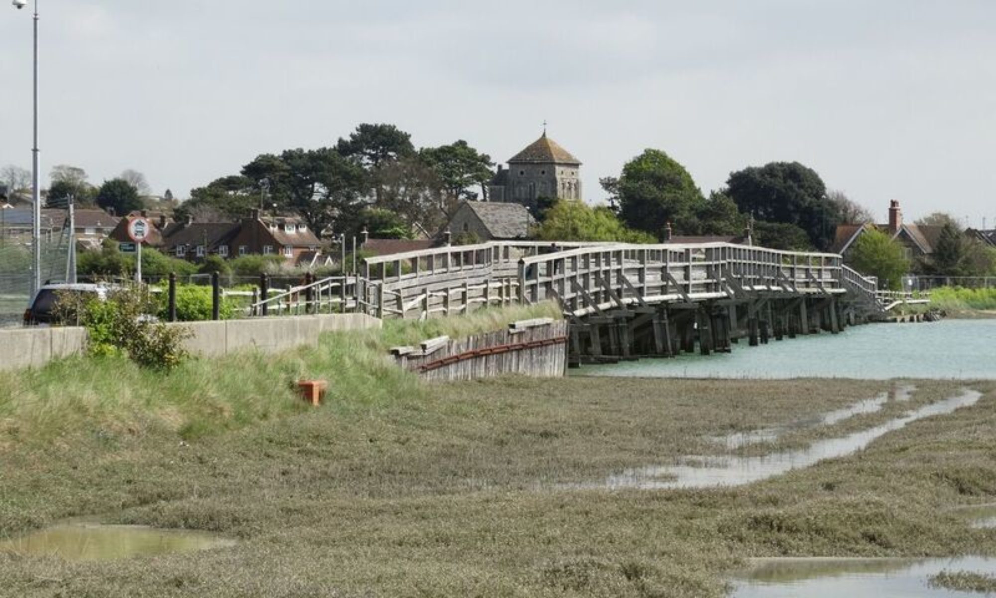
Weather in Shoreham – March 2018


Cold and Wet

Temperatures

The average maximum temperature during March 2018 in Shoreham was 8.9 Celsius (48F), and that was around 1 degree Celsius (1.8F) below normal for the time of year. The average minimum temperature was 3.6 Celsius (39F), and that was  also about 1 degree Celsius (3.5F) below  the March normal.

The highest temperature recorded during the month was 14.2 Celsius (58F) on the 27th, but there was only 1  other day with a maximum above 13 Celsius (55F), and that was the 11th when 13.1 Celsius (55F) was measured. There was a total of 15 days when the temperature rose above 10 Celsius (50F), with a further 5 days when 9 Celsius (48F) was exceeded. There were 2 notable cold snaps during March. The first, was a continuation of the cold weather experienced at the end of February, and on the 1st a maximum of only 0.5 Celsius (33F) was recorded. This appears to be the coldest March day locally since 1986. The following day was only a shade less cold at 1.1  Celsius (34F), but on the 3rd it was much milder at 8.4 Celsius (47F). The onset of the second cold snap was unusually sudden.  After a maximum  of 12.5 Celsius (55F) on the 16th, the high was only 2.6 Celsius (37F) on the 17th, and even colder at 1.1 Celsius (34F) on the 18th. The chill continued into the 19th, when 1.6 Celsius (35F) was measured, but Spring sunshine on the 20th lifted the temperature to a more seasonable 9.4 Celsius (49F).

There were very few mild nights during March, with the highest temperatures generally occurring between the middle of the second week and mid month. On the night of the 9th/10th the temperature only dropped to 8.3 Celsius (47F), and between the 10th and 16th there were 3 other nights when the temperature stayed above 7 Celsius (45F). The only other night with a minimum above 7 Celsius (45F) was the 24th/25th. On most nights (16) the temperature fell to between 2 and 6 Celsius (36-43F), but the cold snaps unsurprisingly produced some much colder nights. On the first night of the month a minimum of minus 4.3 Celsius (24F) occurred, and on the 20th/21st a low of minus 1.7 Celsius (29F) was measured.

The sea temperature was around  6  Celsius (43F)  for much of the month, rising to 7  Celsius (45F) at the end of March.

Frost

There were 6 air frosts in central  Shoreham during March, about 4 above average. They were confined to 2 short spells, namely the first 2 nights of the month, and the 4 consecutive nights beginning on the 17th/18th. On 3 of the 6 nights the temperature only fell to between minus 1 and 0 Celsius (30-32F), but an often penetrating,  low relative humidity, wind, added to the severity of the frosts. There were 12 grass frosts in March.  The 6 that coincided with the air frosts were joined by 6 others scattered through the month. On 6 of the nights, the grass temperature fell below minus 2 Celsius (28F), but only 2 of these nights had grass minima below minus 3 Celsius (27F). The first night of the month had a low of minus 5.0 Celsius (23F), but the coldest night of the month was the 20th/21st with a grass temperature of minus 6.7 Celsius (20F).  

Rain

There were 81.6 millimetres (3.2 ins.) of rain during March and that was almost double  the monthly average. Rain fell on 25 days, about 9 days above what one would expect at this time of year, and wet days ( rainfall of 1 millimetre (0.04 ins) or more)  amounted to 21 days.  Measurable rain fell on the first 12 days of March, but daily totals were fairly small, with the highest being 4.0 millimetres (0.15 ins.) on the 3rd, and 4.8 millimetres (0.2 ins.) on the 12th. The 13th was dry, but the 14th was the wettest day of the month, with heavy rain in the evening and overnight amounting to 16.6 millimetres (0.65 ins.). There was no measurable precipitation between the 19th and 21st, but then the 25th was the only completely dry day during the remainder of the month. Some of the rain was heavy during the last week, with daily totals of 6.8 millimetres (0.3 ins.), 7.2 millimetres (0.3 ins.) and 5.2 millimetres (0.2 ins.) on the 28th, 29th and 30th respectively.

*A rain day is from 0900-0900 UTC

Snow

Sleet or snow fell on 5 days during March, with lying snow observed on 5 mornings. There were 2 centimetres (<1 in.) of lying snow on  the morning of the 1st and light snow or snow grains fell for much of the day. In the evening, there was sleet and freezing rain and this continued overnight and through much of the morning of the 2nd . This helped to reduce the snow depth to 1 centimetres (0.5 ins.). Snow late in the morning freshened up the snow cover, and although no further snow fell during this episode, there was still lying snow on the following morning. Sleet fell mid morning on the 17th, this soon turning to snow and then lasting for most of the day. Snow in the early hours of the 18th produced 4 centimetres (<2 ins.) of lying snow by mid morning, with further snow falling late afternoon and during the evening.  Very light snow fell on the morning of the 19th, by which time the snow depth had decreased to 2 centimetres (<1 in.) . No more snow fell during the month, and by the morning of the 20th only a few patches remained, and these quickly thawed.

Hail

There was no hail observed in Shoreham during March.

Thunder

There was no thunder reported in Shoreham during March.

Wind

The winds during March were fairly evenly distributed, but with a slight bias towards the southeast. The cyclonic nature of the month was responsible for the variability, and generally breezes were only moderate in strength. However, there were exceptions, and at Shoreham Airport  northeasterly gusts of over 30 knots (34 mph) occurred on the evening of the 1st and the morning of the 2nd. Southwesterly gusts exceeded 30 knots (34 mph) on the morning of the 8th, and a northeasterly gust of 33 knots (38 mph) was recorded on the evening of the 19th. 

Fog

No fog was observed from central Shoreham during March.

Statistics for March 2018

Reporting Station Highest Temp Lowest Temp Rain Total (mm) Wettest Rain days
Shoreham Airport 13.9 -4.3 * * *
Thorney Island 13.5 -4.1 90 12 23
Gatwick Airport 15.0 -4.7 88 15 22
Herstmonceux 14.8 -4.5 82 15 18
Bournemouth (Hurn) 14.3 -4.7 142 18 25
Middle Wallop 13.2 -5.6 93 14 21
Dieppe 17.5 -5.2 59 7 20
 * data missing

Weather in Shoreham – February 2018


Dry and cold

Temperatures

The average maximum temperature during February 2018 in Shoreham was 6.5 Celsius (44F), and that was over 1 degree Celsius (1.8F) below normal for the time of year. The average minimum temperature was 0.9 Celsius (34F), and that was  more than 2 degrees Celsius (3.5F) below  the February normal.

The highest temperature recorded during the month was 11.2 Celsius (52F) on the 19th, but there were only 2  other days with maxima above 10 Celsius (50F), the 15th and 18th, with highs of 10.4 and 10.1 Celsius (50F) respectively. On most days  (17) the temperature rose to between 5 and 8 Celsius (41-46F), but there were several cold days. Prior to the 26th, the 6th, with a high of 4.5 Celsius (40F), was the only day when the temperature failed to reach 5 Celsius (41F). However, the last 3 days of the month became steadily colder.  A high of 2.3 Celsius (36F) on the 26th was followed by minus 0.2 Celsius (32F) on the 27th. On the last day of the month a maximum of minus 0.7 Celsius (31F)  was the lowest in February for 24 years, and the lowest so late in the Winter since 1986.

There were very few mild nights during February. In fact, there were only 3 nights when the temperature stayed above 5 Celsius (41F). The 15th and 19th had lows of 6.4 and 6.9 Celsius (44-45F) respectively, but the mildest night of the month was the 20th when the temperature only fell to 9.3 Celsius (49F). On the first 4 nights of February the temperature was 2 Celsius (36F) or higher, and after the 20th there were no minima above 2 Celsius (36F). In between, there was a mixture of cold  and less cold nights. On 4 occasions minima were below minus 2 Celsius (28F), including minus 3.3 Celsius (26F) on the 8th, and minus 3.4 Celsius (26F) on  the 27th. The last complete night of the month was the coldest with a dawn temperature of minus 5.4 Celsius (22F).

The sea temperature was around  8  Celsius (46F) at first, soon falling to 7 Celsius (45F) where it remained for most of the month. However, there was a further drop to 5 or 6 Celsius (41-43F) on the last few days of February.

Frost

There were 12 air frosts in central  Shoreham during February, with 6 of them occurring between the 7th and 16th, and the other 6 on consecutive nights beginning on the 23rd. Most of the air frosts were slight, with 7 of the frosty nights having minimum temperatures between minus 2 and zero Celsius (28-32F) . There were 17 grass frosts during the month,  with 4 of these occurring on consecutive days beginning on the 5th,  and a further 7 confined to the last week of February. The 4 grass frosts during the first week had minim um temperatures above minus 3 Celsius (27F), but on the 8th a ground temperature of minus 7.8 Celsius (18F) was recorded. This temperature was matched on  the 12th, and there were a further 5 nights when the grass minimum dipped below minus 5 Celsius (23F).  

Rain

There were 35.4 millimetres (1.4 ins.) of rain during February and that was less than half the monthly average. Rain fell on 14 days, about 3 days below what one would expect at this time of year, and wet days ( rainfall of 1 millimetre (0.04 ins) or more)  amounted to 7 days.  Although the beginning of the month was unsettled, amounts of rain during the first week were generally small, with the highest total of 1.8 millimetres (0.08 ins.) falling on  the 3rd. On the 8th,  cloud thickened in  the evening and overnight rain produced 6.6 millimetres (0.26 ins.). Another 3.4 millimetres (0.15 ins.) was attributed to the 10th, but it was the end of the second week that produced the wettest weather of the month.   On the 13th a total of 4.6 millimetres (0.2 ins.) fell, but the following day was wetter. On the 14th, rain for much of the day helped to give a total of 13.2 millimetres (0.5 ins.). No more than 4 millimetres (0.15 ins.) fell during the rest of the month, and this included 5 consecutive dry days between the 21st and 25th. The wettest day during this period was the 18th when 1.6 millimetres (0.06 ins) were measured.

*A rain day is from 0900-0900 UTC

Snow

Sleet or snow fell on 6 days during February. A light sleet shower fell late in the morning of the 5th, with a light snow shower falling in the early hours of the 7th. The snow lay in small patches through the morning. On the 12th, there were showers during the evening, one of which fell as sleet. The snowiest weather occurred at the end of the month. Light snow showers fell late on the morning of the 26th, with moderate falls in the evening.  Further snow showers fell on the 27th and 28th, and with the temperature falling below freezing at 1700 hours on the 26th and remaining sub-zero for the remainder of the month, it was inevitable that the snow settled. On the morning of the 27th there were 4 cm (<2 ins.) of snow lying, this decreased to 2 cm (<1 in.) on the 28th    The reduction was mainly due to the powdery nature of the snow, and the dryness of the brisk easterly wind which was accompanied by relative humidity values below 40%.

Hail

There was a  light shower of small hail late evening on the 12th.

Thunder

There was no thunder reported in Shoreham during February.

Wind

February broke the train of ‘westerly’ months. The first week had winds varying between northeast and northwest, followed by a week of breezes mainly from the northwest. A trend towards south or southeasterly winds in the third week was followed by increasingly cold winds from between east and northeast for the remainder of the month. The strongest winds mainly occurred during the second and fourth weeks of the month. At Shoreham Airport,  a gust of 33 knots (38 mph) was recorded early on the 9th, with 32 knots (37 mph) on the evening of the 10th. A similar value was logged early in the afternoon on the 12th. On the morning of the 13th there were gusts of 36 and 38 knots (41-43 mph) and the final gusts of the month above 30 knots occurred on the afternoon and evening of the 28th, when 32 knots (37 mph) was measured.

Fog

No fog was observed from central Shoreham during February.

Statistics for February 2018

Reporting Station Highest Temp Lowest Temp Rain Total (mm) Wettest Rain days
Shoreham Airport 11.4 -6.4 23 8 13
Thorney Island 12.0 -5.9 38 13 13
Gatwick Airport 11.0 -9.9 44 11 17
Herstmonceux 10.9 -6.9 50 10 19
Bournemouth (Hurn) 11.7 -6.7 42 14 12
Middle Wallop 11.9 -6.1 41 13 10
Dieppe 11.1 -6.9 43 9 16
 

Weather in Shoreham – January 2018

Very mild and rather dry

Temperatures

The average maximum temperature during January 2018 in Shoreham was 8.9 Celsius (48F), and that was over 1 degree Celsius (1.8F) above normal for the time of year. The average minimum temperature was 4.9 Celsius (41F), and that was  approaching 2 degrees Celsius (3.5F) above  the January normal.

The highest temperature recorded during the month was 11.8 Celsius (54F) on the 4th, but there were 9  other days with maxima above 10 Celsius (50F), including 2 days with highs above 11 Celsius (52F), namely the 22nd and 24th. There were no particularly cold days during January. In fact, only 3 days had maxima below 7 Celsius (45F). The 6th and 7th had highs of 6.1 Celsius and 6.2 Celsius (43F)  respectively, but the 8th was the coldest day, with the temperature only rising to 4.8 Celsius (41F).

There were several mild nights during January and on 10 occasions the temperature stayed above 7 Celsius (45F). However, only 3 of these milder nights occurred before mid month,  and the 5 nights with lows above 8 Celsius (46F) all occurred during the last 10 nights of January. Included in these were 2 nights with lows above 9 Celsius (48F). The night of the 28th/29th had a low of 9.1 Celsius (48F), but the mildest night was the 23rd/24th when a minimum of 9.6 Celsius (50F) was recorded.  There were a few cold nights during January, with temperatures dipping below 2  Celsius (36F) on 5 nights. The lowest temperature was minus 0.2 Celsius (32F) on the night of the 18th/19th.

The sea temperature was around  9  Celsius (48F) at the turn of the year, but for most of January the temperature was nearer 8 Celsius (46F).

Frost

There was only 1 air frost in central  Shoreham during January, and that was on the 19th. However,  both the 27th and 30th almost had air frosts with night-time temperatures dipping to 0.1 Celsius (32F). There were 7 grass frosts during the month, but only 2 of these occurred before the 19th.  Most of the grass frosts were slight, but on the 18th/19th a grass minimum of minus 5.0 Celsius (23F) occurred, and on  the 26th/27th minus 4.4 Celsius (24F) was recorded.  

Rain

There were 64.4 millimetres (2.5 ins.) of rain during January and that was over 20% below  average. Rain fell on 22 days, about 6 days above what one would expect at this time of year, and wet days ( rainfall of 1 millimetre (0.04 ins) or more)  amounted to 16 days.  Although rainfall was below average, the impression was of a wet month. This was because rain was mostly light, even though it frequently fell. Rain fell on each of the first 5 days of the new year, including a total of 5.8 millimetres (0.2 ins.) on the 3rd. The 6th, 7th and 8th were dry, the only such spell of 3 consecutive dry days during the month.  The 9th to 12th were often damp and drizzly, but with very little rain to measure. On the 14th over 5 millimetres (0.2 ins.) of rain fell, and on the 21st there were 6.8 millimetres (0.3 ins.). This was the wettest day of the month, and although the weather remained unsettled during the remainder of the month, amounts of rain stayed fairly small with no individual day exceeding 5 millimetres (0.2 ins.).

*A rain day is from 0900-0900 UTC

Snow

No snow fell in Shoreham during January.

Hail

There was a hail shower late morning on the 31st.

Thunder

There was no thunder reported in Shoreham during January.

Wind

January was a ‘westerly’ month, with winds from between southwest and northwest dominating on 24 days. There were a few days with easterly winds, with all of these occurring during the first half of the month. It was often breezy, especially during the first few days of January. At Shoreham Airport,  a gust of 39 knots (44 mph) was recorded late on the 2nd, and 47 knots (54 mph) early on the 3rd. On the morning of the 15th gusts of 38 knots (41 mph) occurred,  with 49 knots (56 mph) logged before dawn on the 18th. On several days during the rest of January there were gusts between 25 and 35 knots (29 and 40 mph).

Fog

No fog was observed from central Shoreham.

Statistics for January 2018

Reporting Station Highest Temp Lowest Temp Rain Total (mm) Wettest Rain days
Shoreham Airport 11.4 -3.1 71 10 22
Thorney Island 12.6 -0.9 76 16 22
Gatwick Airport 13.0 -2.8 69 12 23
Herstmonceux 11.9 -1.1 93 11 23
Bournemouth (Hurn) 13.2 -2.3 79 11 24
Middle Wallop 13.7 -1.3 81 17 22
Dieppe 14.5 0.0 107 15 23
 

Weather in Shoreham – December 2017

Rather wet with a typical mix of winter weather

Temperatures

The average maximum temperature during December 2017 in Shoreham was 8.4 Celsius (47F), and that was very close to normal for the time of year. The average minimum temperature was 3.8 Celsius (39F), and that was  also very close to the December normal.

The highest temperature recorded during the month was 12.6 Celsius (55F) on the 30th. There were no other days with maxima above 12 Celsius (54F), but there were 3 more days with highs above 11 Celsius (52F), and a further 6 days when the temperature exceeded 10 Celsius (50F). The mildest weather was generally during the first week and final fortnight of December, although there  were no especially cold days during the remainder of the month. However, the temperature failed to rise above 5 Celsius (41F) on 3 days. The 9th had a high of 4.2 Celsius (40F) and the 11th had a maximum of 3.3 Celsius (38F). This was the coldest day of the month, but the windy 27th, with a high of 3.9 Celsius (39F), felt just as cold.

There were several mild nights during December and on 6 occasions the temperature stayed above 8 Celsius (46F). Only 1 of these mild nights occurred before the 20th,  and that was on the 6th/7th when a minimum  of 8.8 Celsius (48F) was recorded.  Apart from the 30th/31st, when a low of 8.6 Celsius (48F) was measured, the remainder of the mild nights occurred between the 21st and 25th. This included 3 nights when the temperature kept above 9 Celsius (48F). The highest minimum was 9.3 Celsius (49F) on Christmas Eve night. There were many chilly nights during December, and on 16 occasions the minimum temperature was below 3 Celsius (37F). The coldest nights generally occurred during the second and third weeks of December, with 11 nights between the 8th and 19th having minima below 3 Celsius (37F). The lowest temperature recorded was minus 2.4 Celsius (28F) on the night of the 11th/12th.

The sea temperature was mostly between 9 and 10 Celsius (48-50F).

Frost

There were 6 air frosts in Shoreham during December, but all of these were slight. On the 8th/9th a temperature of minus 1.7 Celsius (29F) occurred, with minus 1.4 Celsius (30F) and minus 1.0 Celsius (30F) on the nights of 16th/17th and 18th/19th respectively.  Consecutive air frosts were logged on the 27th/28th and 28th/29th but the temperatures fell no lower than minus 1.4 Celsius (30F). There were 12  grass frosts during December, with 9 of them occurring between the 9th and 19th. On 3 occasions during this frosty spell the grass temperature fell below minus 5 Celsius (23F), including a low of minus 6.1 Celsius (21F) on the 8th/9th. This grass temperature was matched on the night of the 28th/29th.  

Rain

There were 103.2 millimetres (1.25 ins.) of rain during December and that was over 30% above  average. Rain fell on 22 days, about 6 days above what one would expect at this time of year, and wet days ( rainfall of 1 millimetre (0.04 ins) or more)  amounted to 15 days.  High pressure was prominent during the first few days of the month, and although the weather was often cloudy and damp, amounts of rain during this period were mostly small. This changed on the 9th when rain in the evening became persistent and heavy overnight amounting to 22 millimetres (0.9 ins.) by morning. A further 8 millimetres (0.3 ins.) were measured on the 10th, with a further 15 millimetres accumulating over the following 5 days. Once again, pressure rose, and although occasional rain or drizzle occurred, the period between the 16th and 23rd only produced 4 millimetres (0.15 ins.) of rain. Showers, merging into longer spells of rain, occurred on Boxing Day afternoon, with the rain lasting overnight. A total of 21 millimetres   (0.8 ins.) was measured on the 26th, with a further 25 millimetres (1 in.) of rain falling during the rest of the month. This included over 5 millimetres (0.2 ins.) on 3 consecutive days, the 28th, 29th and 30th.

*A rain day is from 0900-0900 UTC

Snow

Snow fell on 2 days during December. On  the morning of the 11th rain turned to sleet and wet snow for a while in the morning and  settled on some vegetation before quickly thawing.  On the 27th, early rain turned to sleet, then wet snow, around mid morning. It settled for a while, but further rain brought about a steady thaw by late morning.

Hail

There was no hail reported  in Shoreham during December.

Thunder

There was no thunder reported in Shoreham during December.

Wind

December was another ‘north-westerly’ month with winds from that direction dominating on a remarkably high 19 days. On most other days the wind blew from between southeast and southwest. It was frequently windy, especially during the second and last weeks of the month. At Shoreham Airport,  a gust of 38 knots (43 mph) was recorded on the 7th,  53 knots (60 mph) on  the 10th,  35 knots (40 mph) on the 14th,  42 knots (48 mph) on the 25th,  35 knots (40 mph) on the 26th,  40 knots (46 mph) on the 27th, 42 knots (48 mph) on the 29th, and  43 knots (49 mph) on the 31st.

Fog

Fog over the Downs, descended to lower levels at times during the mornings of the 20th and 21st.

Statistics for December 2017

Reporting Station Highest Temp Lowest Temp Rain Total (mm) Wettest Rain days
Shoreham Airport 12.7 -4.3 87 18 18
Thorney Island 12.6 -3.2 98 20 19
Gatwick Airport 13.4 -4.5 109 25 21
Herstmonceux 12.3 -3.5 129 24 21
Bournemouth (Hurn) 13.6 -6.9 103 22 19
Middle Wallop 13.3 -3.9 103 21 19
Dieppe 14.5 0.0 117 27 23
 

Weather in Shoreham – November 2017

Dry and rather cold

Temperatures

The average maximum temperature during November 2017 in Shoreham was 10.9 Celsius (52F), and that was close to normal for the time of year. The average minimum temperature was 4.8 Celsius (41F), and that was  more than 1 Celsius (1.8F) below  the normal November value.

The highest temperature recorded during the month was 15.7 Celsius (60F) on the 1st. There were 3 other very mild days, the 4th and 22nd,  both with highs of 14.7 Celsius (59F),  and the 10th with a maximum of 14.1 Celsius (57F).  A further 6 days had highs above 13 Celsius (55F).  There was a general lowering of temperatures during the month with only 2 of the 10 mildest days occurring after mid month. There were no particularly cold days during November, but on 11 days the maxima remained below 10 Celsius (50F). Only 3 of these colder days occurred before mid month, whilst 6 were logged during the final week of the month. In fact, the 5 coldest days of the month occurred between the 25th and 30th. On 3 of these days the maximum temperature was just above 7 Celsius (45F), but on the 29th the maximum was only 5.6 Celsius (42F).  However, the 30th was the coldest day of the month with a high of just 4.2 Celsius (40F).

There were several mild nights during November, but perhaps surprisingly,  the mildest nights were in  the second half of the month. On 5 occasions the temperature stayed above 10 Celsius (50F). The 4th, 7th and 23rd each had minima above 10 Celsius (50F), but only the 21st and 22nd night-time had temperatures above 11 Celsius (52F). The lowest value on the 21st was 11.7 Celsius (53F), but on the following night the minimum was 12.8 Celsius (55F). There were many chilly nights, and on 17 occasions the temperature dipped below 5 Celsius (41F), including 9 nights when the temperature fell below 2 Celsius (36F). However, only 1 of these colder nights occurred before mid month.  On the 9th, a minimum of 1.7 Celsius (35F) was recorded. There were chilly nights between the 17th and 20th, but the coldest nights were confined to the last week of November. On the 25th there was a minimum of minus 0.9 Celsius (30F), but the following night was a fraction colder at minus 1.0 Celsius (30F).

The sea temperature fell steadily from 14 or 15 Celsius (57-59F) at the beginning of November to  11 Celsius (52F) at the end of the month.

Frost

There were 3 air frosts in Shoreham during November. The 25th, 26th and also the 30th, when a minimum of minus 0.1 Celsius (32F) was recorded. There were 9 grass frosts, but only 2 of these occurred before the 18th. The 6th and 9th had grass minima of minus 2.2 Celsius (28F) and minus 1.7 Celsius (29F) respectively. Three consecutive nights,  the 18th, 19th and 20th, had grass frost, and on the 18th and 19th there were grass minima of minus 3.3 Celsius (26F).  Another minimum of minus 3.3 Celsius (26F) occurred on the 25th. On  the following night the ground temperature plunged to minus 5 Celsius (23F), with grass frost also recorded on the 28th and the last night of the month.

Rain

There were 31.8 millimetres (1.25 ins.) of rain during November, and that was less than 40% of the  average. Rain fell on 13 days, about 3 days below what one would expect at this time of year, and wet days ( rainfall of 1 millimetre (0.04 ins) or more)  amounted to 10 days. The month was unsettled with the end of November producing the only spell of 3 completely dry days. However, amounts of rain were mostly small with only 4 days recording more than 2 millimetres (0.08 ins.). On the 7th, a total of 6.2 millimetres (0.2 ins.) was measured, and this proved to be the wettest day of the month. The 10th and 11th both recorded over 5 millimetres (0.2 ins.) of rain, and another 5.4 millimetres were logged on the 22nd. Small amounts of measurable rain then fell on 3 days during the remainder of the month.

*A rain day is from 0900-0900 UTC

Hail

There was no hail reported  in Shoreham during November.

Thunder

There was no thunder reported in Shoreham during November.

Wind

November was an unusual ‘north-westerly’ month with winds from that direction dominating on 18 days. It was quite breezy at times, especially in the latter half of the month, and although there were no exceptional gusts, there were readings above 25 knots (29 mph) at Shoreham Airport on 9 days. The highest gust recorded was 42 knots (48 mph), from the southwest, late in the evening on the 22nd and in the early hours of the 23rd.

Fog

There was no fog observed in this part of Shoreham during November.

Statistics for November 2017

Reporting Station Highest Temp Lowest Temp Rain Total (mm) Wettest Rain days
Shoreham Airport 15.3 -2.3 35 6 15
Thorney Island 15.4 -2.7 39 11 14
Gatwick Airport 15.4 -4.2 44 9 17
Herstmonceux 15.1 -1.9 41 10 16
Bournemouth (Hurn) 15.5 -3.6 83 37 19
Middle Wallop 15.7 -2.0 73 22 21
Dieppe 16.0 1.7 126 17 18
 

Weather in Shoreham – October 2017

A dry and mild month

Temperatures

The average maximum temperature during October 2017 in Shoreham was 16.3 Celsius (61F), and that was over 1 Celsius (1.8F) above normal for the time of year. The average minimum temperature was 10.9 Celsius (52F), and that was  also more than 1 Celsius (1.8F) above  the normal October value.

The highest temperature recorded during the month was 19.8 Celsius (68F) on the 16th. This was the day of the orange sun and day darkness caused by Saharan dust and smoke from Iberian forest fires spreading north in the southerly airstream.  The 16th was the only day with a maximum temperature above 19 Celsius (66F), however, there were 6 other days when maxima  exceeded  18 Celsius (64F). On most days (20) the temperature rose to between 15 and 18 Celsius (59-64F), but there were a few cooler days later in the month. The 22nd was the first of these less mild days with a high of 13.8 Celsius (57F). This was the second coolest day of the month. There were  3 other days when the temperature failed to reach 15 Celsius (59F), but only 1 of those days had a maximum below 14 Celsius (57F), that was the 30th, with a high of 11.4 Celsius (52F), the coolest day of the month.

There were many mild nights during October, and on 10 nights the temperature remained above 13 Celsius (55F). On 7 of these milder nights the minima were 14 Celsius (57F) or higher. The mildest nights were both the 14th  and 19th when lows of 14.8 Celsius (59F) were recorded.  There were 12 nights when the temperature fell below 10 Celsius (50F), but only 3 of these cooler nights had minima under 7 Celsius (45F). The end of the month was coolest with 3 out of the last 4 nights recording temperatures below 5 Celsius (41F). The coolest night was the 30th with a reading of 3.2 Celsius (38F).

The sea temperature,  around 17 Celsius (63F) at the beginning of October,  fell slowly to 14 or 15 Celsius (57-59F) by the end of the month.

Frost

There were no frosts in Shoreham during October. The lowest grass minimum was 0.0 Celsius (32F) on the 28th.

Rain

There were 30.4 millimetres (1.2 ins.) of rain during October, and that was less than 50% of the  average. Rain fell on 15 days, about 2 days above what one would expect at this time of year, and wet days ( rainfall of 1 millimetre (0.04 ins) or more)  amounted to 9 days. The first half of the month was generally dry, and although measurable rain fell on 6 days, the total was only 6.8 millimetres  (0.3 ins.) between the 1st and 16th. Rain then fell on the following 9 days with 9.2 millimetres  (0.36 ins.) recorded on  the 19th and 5.6 millimetres  (0.22 ins.) collected on the 20th. Most of the rain was then light, and during the last 6 days of October there was no measurable rain.

*A rain day is from 0900-0900 UTC

Hail

There was no hail reported  in Shoreham during October.

Thunder

There was no thunder reported in Shoreham during October.

Wind

October was another ‘westerly’ month with well over half of winds blowing from between southwest and northwest.  It  was often quite breezy early in the month, and again  during the unsettled spell,  but it became generally less windy towards the end of October. At Shoreham Airport,   a gust of 42 knots (48 mph) was recorded in the early hours of the 20th,  with 45 knots (51 mph) measured during the afternoon on the following day.

Fog

There was no fog observed in this part of Shoreham during October except for a while in the evening and overnight on the 25th/26th.

Statistics for October 2017

Reporting Station Highest Temp Lowest Temp Rain Total (mm) Wettest Rain days
Shoreham Airport 20.0 0.9 39 9 19
Thorney Island 18.8 3.1 38 9 18
Gatwick Airport 21.4 0.8 34 8 17
Herstmonceux 21.5 4.1 39 10 17
Bournemouth (Hurn) 19.3 -1.4 46 11 17
Middle Wallop 19.1 1.2 36 8 13
Dieppe 24.4 6.3 48 22 15
 

Weather in Shoreham – September 2017

A changeable, rather wet, month

Temperatures

The average maximum temperature during September 2017 in Shoreham was 18.8 Celsius (66F), and that was less than 1 Celsius (1.8F) above normal for the time of year. The average minimum temperature was 11.7 Celsius (53F), and that was  slightly below the normal September value.

The highest temperature recorded during the month was 21.9 Celsius (72F) on both the 1st and 26th, but there were 4 other days when the temperature rose above 20 Celsius (68F). On most days the temperature rose to between 17 and 20 Celsius (63-68F), with only 2 days having maxima below 17 Celsius (63F). These cooler days were the 19th and 30th with highs of 16.2 Celsius (61F) and 16.9 Celsius (63F) respectively..

There were few warm nights during September, and minima above 15 Celsius (59F) only occurred on 3 nights. The 4th/5th had a low of 16.8 Celsius (62F), The 7th/8th was also a warm night, and on  the 27th/28th a low of 15.6 Celsius (60F) was recorded. There were several fairly cool nights, these mainly occurring around the middle of the month. There was a total of 10 nights with minima below 10 Celsius, with 9 of these cooler nights occurring between the 10th and 22nd. Only 4 nights had  a minimum temperature below 9 Celsius (48F), with just the 17th dipping below 8 Celsius (46F). The minimum on the night of the 16th/17th was 7.2 Celsius (45F).

The sea temperature,  around 19 Celsius (66F) at the beginning of September fell to 16 or 17 Celsius (61-63F) after mid month.

Frost

There were no frosts in Shoreham during September. The lowest grass minimum was 3.3 Celsius (38F) on the 15th.

Rain

There were 63.8 millimetres (2.5 ins.) of rain during September, and that was over 25% above average. Rain fell on 20 days, about 9 days above what one would expect at this time of year, and wet days ( rainfall of 1 millimetre (0.04 ins) or more)  amounted to 13 days. No measurable rain fell on the first 2 days of the month, but 3 millimetres (0.1 ins.) fell on the 3rd,  and only twice more during the month were there 2 consecutive days without measurable rain. After another 3 millimetres (0.1 ins.) on the 7th, over 9 millimetres (0.35 ins.) of rain were recorded on the 8th. Amounts of rain were generally small between  the 9th and 26th, although on 3 occasions, the 12th, 18th and 24th, rainfall totalled between 3 and 4 millimetres (about 0.1 ins.). The 27th was particularly wet in the evening and overnight with 17.8 millimetres (0.7 ins.) added to the monthly total. Over 4 millimetres (0.15 ins.) was logged for the 28th, with a further 5 millimetres (0.2 ins. ) falling on the last day of the month.

*A rain day is from 0900-0900 UTC

Hail

There was no hail reported  in Shoreham during September.

Thunder

There was no thunder reported in Shoreham during September.

Wind

September was another ‘westerly’ month with over two thirds of winds blowing from between southwest and northwest. The first half of September was often quite breezy but it became generally less windy after mid month. At Shoreham Airport  a gust of 44 knots (50 mph) was recorded early in the evening of the 10th, with 38 knots (43 mph) measured late morning on the following day. A further gust of 44 knots (50 mph) occurred  in the early hours of the 13th.

Fog

There was no fog observed in Shoreham during September.

Statistics for September 2017

Reporting Station Highest Temp Lowest Temp Rain Total (mm) Wettest Rain days
Shoreham Airport 20.9 6.0 58 18 20
Thorney Island 20.2 5.5 64 16 20
Gatwick Airport 22.1 3.7 70 16 25
Herstmonceux 21.5 5.4 75 14 23
Bournemouth (Hurn) 21.2 1.4 69 12 23
Middle Wallop 21.8 3.7 63 9 21
Dieppe 23.1 6.0 121 21 22
 

Weather in Shoreham – August 2017

A wet month, but a fine and warm Bank Holiday weekend

Temperatures

The average maximum temperature during August 2017 in Shoreham was 21.5 Celsius (70F), and that was less than 1 Celsius (1.8F) above normal for the time of year. The average minimum temperature was 13.4 Celsius (56F), and that was almost 1 Celsius (2F) below the normal August value.

The highest temperature recorded during the month was 26.3 Celsius (79F) on the 27th, but the 29th was only 0.1 Celsius (0.2F) less warm. These were the only 2 days with temperatures above 25 Celsius (77F), but during the last week of August there were a further 3 days with maxima above 23 Celsius (73F). The 14th and 15th were the only other days with highs above 23 Celsius (73F). On most days (18) the temperature rose to between 20 and 23 Celsius (68-73F), but there were 6 occasions when the maxima failed to reach 20 Celsius (68F). On 4 of these days, the temperature was only a fraction of a degree below 20 Celsius (68F), but on the 2nd the high was only 18.4 Celsius (65F), and on the 30th it was decidedly cool. The temperature only reached 15.1 Celsius (59F), making it the coolest August day for 14 years..

There were several warm nights during August,  and on 10 occasions the temperature remained above 15 Celsius (59F). However, only 1 of these warmer nights had minima  above 17 Celsius (63F), namely the 23rd when 17.7 Celsius (64F) was recorded. There were 3 fairly cool nights in August and on these occasions minimum temperatures were below 10 Celsius (50F). On the 20th the temperature fell fractionally below 10 Celsius (50F), but on both the 14th and 31st minima were below 9 Celsius (48F). The lowest reading was 8.1 Celsius (46F) on the 31st.

The sea temperature stayed around 19 Celsius (66F) throughout the month.

Frost

There were no frosts in Shoreham during August. The lowest grass minimum was 5.6 Celsius (42F) on both the 20th and 31st.

Rain

There were 84.4 millimetres (3.3 ins.) of rain during August, and that was approaching 50% above average. Rain fell on 13 days, a couple of days above what one would expect at this time of year, and wet days ( rainfall of 1 millimetre (0.04 ins) or more)  amounted to 10 days, also slightly above what can be expected in August. No measurable rain fell on the first day of the month, but the 2nd was very wet with 28 millimetres (1.1 ins. falling). The weather stayed changeable, although amounts of rain were small until the 8th. On the 8th, over 3 millimetres (0.1 ins.) of rain fell, with a further 11.6 millimetres (0.5 ins.) recorded on the 9th. Although the day was fine, overnight rain produced nearly 8 millimetres (0.3 ins.) on the 16th,  and over 16 millimetres  (0.6 ins.) fell on the 20th. There was a run of 6 dry days between the 23rd and 28th but there was an unsettled end to the month with almost 7 millimetres (0.3 ins.) of rain falling on the 31st.

*A rain day is from 0900-0900 UTC

Hail

There was no hail reported  in Shoreham during August.

Thunder

There were 4 days when thunder was observed in Shoreham.  Early in the afternoon on the 5th a storm occurred over the Downs but with no rain in central Shoreham. A rumble of thunder occurred late in the morning of the 8th and there was lightning and a few distant thunderclaps late on the evening of the 22nd. The last thunder of the month was noted mid afternoon on the 31st.

Wind

August was a ‘westerly’ month with around two thirds of winds blowing from between southwest and northwest. The first half of August was often quite breezy but it became generally calmer after the 20th. At Shoreham Airport a gust of 37 knots (42 mph) occurred on the morning of the 3rd, with 36 knots (41 mph) recorded on the afternoon of the 18th.

Fog

There was no fog observed in Shoreham during August.

Statistics for August 2017

Reporting Station Highest Temp Lowest Temp Rain Total (mm) Wettest Rain days
Shoreham Airport 24.5 5.3 90 22 17
Thorney Island 25.3 7.3 * * *
Gatwick Airport 27.4 5.4 50 14 12
Herstmonceux 27.3 7.0 * * *
Bournemouth (Hurn) 25.8 4.6 * * *
Middle Wallop 27.3 7.7 * * *
Dieppe 28.9 8.9 90 32 16
 *Data missing

Weather in Shoreham – July 2017

A warm, but also a wet and windy month

Temperatures

The average maximum temperature during July 2017 in Shoreham was 22.5 Celsius (73F), and that was 2 Celsius (3.5F) above normal for the time of year. The average minimum temperature was 14.8 Celsius (59F), and that was almost 1 Celsius (2F) above the normal July value.

The highest temperature recorded during the month was 29.7 Celsius (86F) on the 18th, but there were 4 other warm days when the temperature rose above 25 Celsius (77F). All of the warm weather occurred during the first 18 days of the month, including maxima of 27.3 Celsius (81F) on the 6th and 27.1 Celsius (81F) on the 9th.; after that, the only maximum above 23 Celsius (73F) was the 23.4 Celsius (74F) recorded on the 21st. There were many days when temperatures rose to between 20 and 23 Celsius (68-73F), but there were 4 days when maxima remained below 20 Celsius (68F). The only day when the temperature failed to reach 19 Celsius (66F) was the 26th when a high of 18.6 Celsius occurred.

There were several warm nights during July. and on 13 occasions the temperature remained above 15 Celsius (59F). On 5 of these warmer nights minima were above 17 Celsius (63F), including a low of 18.2 Celsius (65F) on the 6th. There were no particularly cool nights during July, although on 3 nights minima were below 13 Celsius (55F).  On the 4th a low of  11.6 Celsius (53F) occurred, but the coolest night of the month was the 22nd/23rd when a minimum of 10.3 Celsius (50F) was measured..

The sea temperature stayed at 18 or 19 Celsius (64-66F) throughout the month..

Frost

There were no frosts in Shoreham during July. The lowest grass minimum was 7.8 Celsius (46F) on the 4th.

Rain

There were 81.8 millimetres (2.1 ins.) of rain during July, and that was approaching 50% above average. Rain fell on 11 days, close to what one would expect at this time of year, and wet days ( rainfall of 1 millimetre (0.04 ins) or more)  amounted to 9 days, also close to what can be expected in July. No measurable rain fell during the first 10 days of July, but rain set in during the afternoon of the 11th and became heavy at times overnight. The total for the rainfall day* was 26.6 millimetres  (1.05 ins.).  A short dry spell ensued but rain on the evening of the 18th became torrential for a while overnight and resulted in a total of 25.6 millimetres (1 inch) of rain. A changeable period of weather followed, and between the 18th and 29th there was only 1 completely dry day, the 21st. Some heavy bursts of rain occurred, with 7.8 millimetres (0.3 ins.) measured on the 21st, almost 5 millimetres (0.2 ins.) on the 22nd, and 9 millimetres (0.35 ins.) on the 29th. The last 2 days of the month were dry.

*A rain day is from 0900-0900 UTC

Hail

There was no hail reported  in Shoreham during July.

Thunder

There were 3 days when thunder was observed in Shoreham. On the evening of the 18th thunderstorms broke out, with these becoming severe in the early hours of the 19th. Continuous thunder and lightning occurred for over an hour before they finally moved away to the north. At one stage, the rain was falling at a rate of almost 90 millimetres (3.5 ins.) per hour.  The  last thunderstorm of the month, on the 22nd, was slight, and produced just 2 rumbles in the middle of the afternoon..

Wind

It was a windy July, especially during the second half of the month. Winds from a southwesterly direction accounted for nearly 60% of the observations,  although breezes from a northeasterly point coincided with some of the warm days. The 28th was the windiest day at the Airport with 34 knots (39 mph) recorded.

Fog

There was no fog observed in Shoreham during July.

Statistics for July 2017

Reporting Station Highest Temp Lowest Temp Rain Total (mm) Wettest Rain days
Shoreham Airport 28.2 8.6 79 22 12
Thorney Island 28.3 9.4 * * *
Gatwick Airport 29.7 7.7 * * *
Herstmonceux 27.3 9.3 70 24 12
Bournemouth (Hurn) 28.5 6.8 * * *
Middle Wallop 29.1 7.4 89 24 14
Dieppe 33.6 10.7 35 13 17
 *Data missing

Weather in Shoreham – June 2017

A very warm, but also a rather wet, month

Temperatures

The average maximum temperature during June 2017 in Shoreham was 22.1 Celsius (72F), and that was almost 4 Celsius (7F) above normal for the time of year. The average minimum temperature was 13.5 Celsius (56F), and that was over 1 Celsius (2F) above the normal June value.
The highest temperature recorded during the month was 31.7 Celsius (89F) on the 21st, but there were several other very warm days between the 17th and 21st, including the 18th with 30.1 Celsius (86F) and 30.4 Celsius (86F) on the 20th. The temperature reached 27.0 Celsius (81F) on the 14th, and in total there were 6 days when the temperature rose above 25 Celsius (77F). There was plenty of fairly warm weather, with a further 13 days when the temperature exceeded 20 Celsius (68F). There were no particularly cool days during June, and although the temperature failed to rise above 18 Celsius (64F) on 3 occasions, the lowest value for the month was 17.0 Celsius (63F), some 6 Celsius (11F) above the record low for June.

There were several warm nights during June. but with most of the warmer nights occurring after mid month. There were 8 nights with minimum temperatures above 15 Celsius (59F), although only 1 of these warmer nights occurred before mid month. On the 11th a minimum of 15.4 Celsius (60F) was measured, although this figure was exceeded on 5 nights between the 19th and 24th. On the night of the 20th/21st a low of 18.1 Celsius (64F), occurred, with the following night 1 Celsius (1.8F) cooler.  There were no especially chilly nights, although on 2 occasions the temperature fell below 10 Celsius (50F),  The coldest night, by a fraction, was the 3rd/4th,  when a minimum of 9.8 Celsius (50F) was measured.
The sea temperature climbed steadily from 13 Celsius (55F) at the beginning of June to a comfortable 18 or 19 Celsius (64-66F) during the third week. Despite lower air temperature, the sea stayed relatively warm until the end of the month.

Frost

There were no frosts in Shoreham during June. The lowest grass minimum was 6.1 Celsius (43F) on the 13th.

Rain

There were 53.0 millimetres (2.1 ins.) of rain during June, and that was about 20% above average. Rain fell on 9 days, close to what one would expect at this time of year, but wet days ( rainfall of 1 millimetre (0.04 ins) or more) only amounted to 4 days, roughly half of what can be expected in June. A little rain fell on the 2nd, but the first high rainfall occurred on the 5th. A total of 21.4 millimetres (0.8 ins.) was measured with a further 6.6 millimetres (0.25 ins.) logged on the 8th.  No measurable rain fell between the 9th and 21st (13 days) and only just over 1 millimetre (0.05 ins.) fell between the 22nd and 26th. However, on the following day, steady rain contributed another 22.2 millimetres  (0.9 ins.) to the monthly total.  Almost 95% of the June rain total fell on just 3 days, the 5th, 8th and 27th. Although it rained on the last 3 days of the month, once again amounts were small.

*A rain day is from 0900-0900 UTC

Hail

There was no hail reported  in Shoreham during June.

Thunder

There were 3 days when thunder was observed in Shoreham. Showery rain on the evening of the 8th produced 1 late flash and rumble. On the morning of the 22nd there was plenty of thunder but most of it stayed to the west and north. On the 27th there were a couple of late morning thunderstorms embedded in the steady rain.
Wind

After a quiet start to the month, it became very windy at the end of the first week with southwesterly gusts at Shoreham Airport reaching 40 and 35 knots (46 and 40 mph) on the 6th and 7th respectively.  Southwesterly winds continued into the second week, but after mid month breezes were generally lighter, except between the 22nd and 26th, and often blowing from between northwest and northeast..

Fog

There was no fog observed in Shoreham during June.

Statistics for June 2017

Reporting Station Highest Temp Lowest Temp Rain Total (mm) Wettest Rain days
Shoreham Airport 28.1 7.8 55 16 12
Thorney Island 29.0 8.4 47 18 8
Gatwick Airport 33.3 6.7 55 23 9
Herstmonceux 31.6 9.1 76 25 9
Bournemouth (Hurn) 30.6 5.7 57 24 9
Middle Wallop 31.6 7.0 93 60 9
Dieppe 34.9 9.4 29 9 9